 Weather Station DetailsWeather Station Details
 This station updates this present web page every 900 seconds. This present Report is Timed: Tuesday, 14 January 2003, 1:22 p.m.
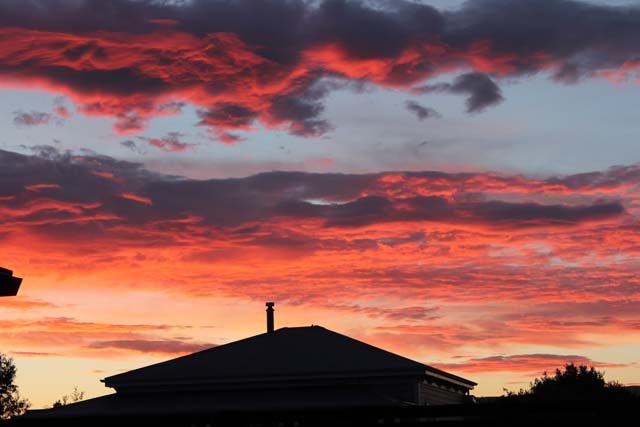
The photo on the left is from a sky camera and is updated every 900 seconds (temporarily disconnected)
![]()
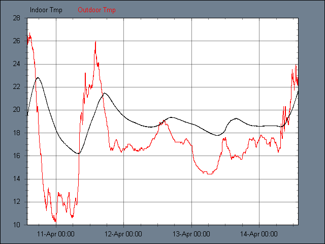
Air Temperature
![]()
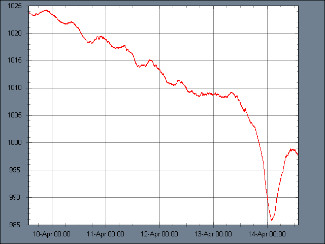
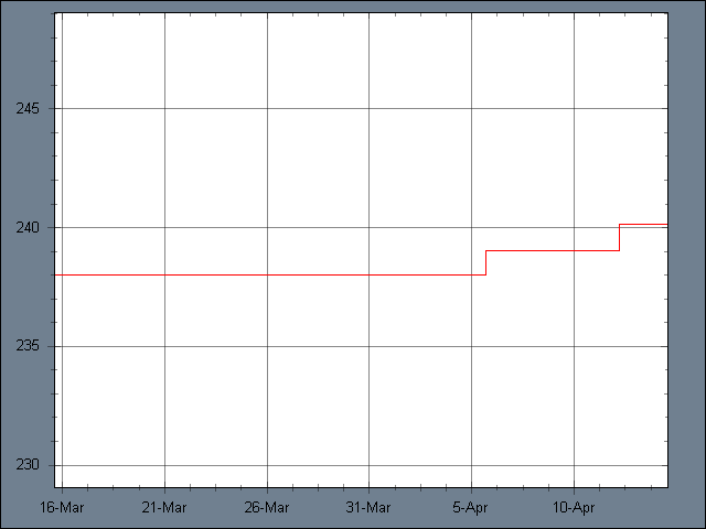
Air Pressure Barometer
![]()
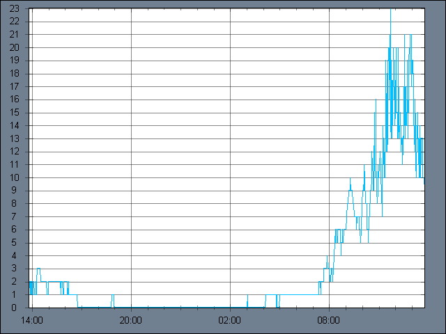
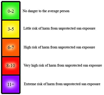
Ultra Violet Reading
![]()
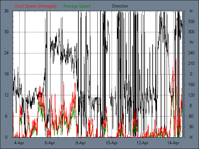
Wind Speed Anemometer

![]()
Rainfall
![]()
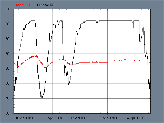
Relative Humidity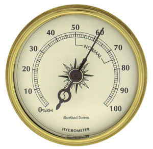
![]()
Sun and Moon
![]()
Forecast
![]()
Martinborough Sunshine Hours
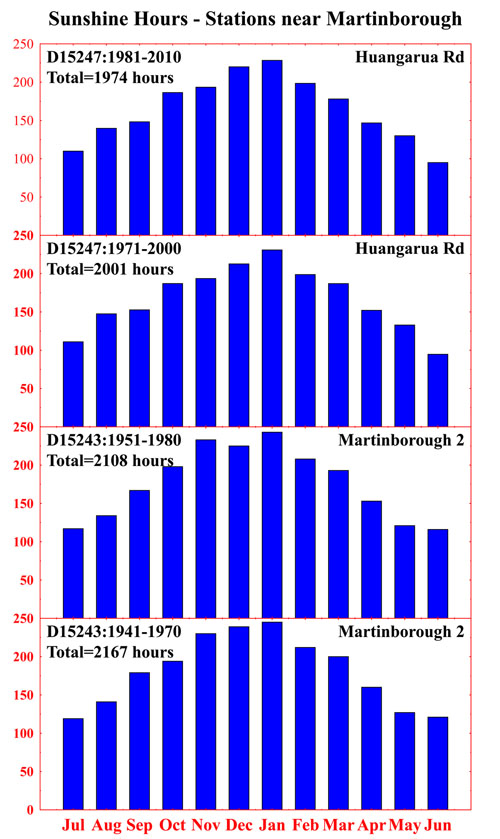
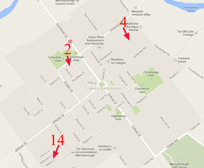
NIWA has records from 13 Stations within a 9 km radius of the station at Venice Street Martinborough. Only a few of these have historical records relating to sunshine hours. Two which have long series are stations D15243 and D15247, marked as numbers 2 and 4 on the map below. The new station at Cottage Grove appears as number 14. On the right, some historical information is presented in summary form for stations 2 and 4. The Martinborough area clearly enjoys high sunshine hours per annum. It is interesting that the average appears to be somewhat higher to the south-west of the township, away from the Huangarua River. January and December receive the highest sunshine each year.
Martinborough Rainfall Records
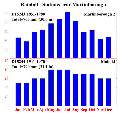
There are quite a few stations reporting rainfall data to NIWA without much variation. Two suffice to show the monthly pattern. The Mahaki figures were rounded to the nearest 10 mm each month which explains the unusual pattern. However, the annual figure is much the same as for Martinborough 2 near Venice Street. Summer months receive about half of those during winter. The annual rainfall in Martinbrough is about 760 mm (30 inches).
Network
Date Range
Name
Latitude
Longitude
1: D15246
1990-2000
Martinborough Venice St
-41.23
175.459
2: D15243
1970-1980
Martinborough 2
-41.218
175.456
3: D15242
1970-1980
Martinborough
-41.217
175.45
4: D15247
2000-2010
Martinborough Huangarua Rd
-41.213
175.465
5: D15244
1970-2010
Mahaki
-41.23752
175.42503
6: D15251
1970-2010
Martinboro Puruatanga
-41.23
175.498
7: D15241
1970-1980
Martinborough S.Downs
-41.26
175.43
8: D15143
1970-1980
Ruamahanga
-41.183
175.433
9: D15142
1970-2010
Martinbor Riverside
-41.179
175.482
10: D15234
1910-2010
Martinborough Ews
-41.25231
175.38985
11: D15252
1970-1980
Ngarara
-41.233
175.55
12: D15232
1970-1980
Pihautea
-41.217
175.367
13: D15141
1970-1980
Morrisons Bush
-41.15
175.467
14: ZL2JKP-10
2013-
Waihinga
-41.2273
175.4518
![]()